Awesome services
Services
Roads are the main infrastructure and economic nerves of cities around the world, local governments spend a lot of effort, time, and money to keep these nerves in good conditions, by running maintenance and rehabilitation projects (in Daily, Monthly, and Annual basis), it’s very hard and expensive process for governments to continuously tracking the structural conditions and deterioration of its roads network, and therefore they can’t make good decisions about where, when, and how to maintain their roads.
Road-Infinity Services:
• GIS Based City Roads and Segments Network.
• GIS Based Infrastructure Consultation Services.
• Annual Mobile Based Roads Segments Scan.
• Roads Assessment and Distresses Allocation with Coordinates and Details.
• 5 Level Color-Coded Map.
• Roads DSS & Maintenance Priority setting.
• Inventory of Road Images Every 3m.
• Intersection to Intersection Segment Analysis.
• Maintenance performance measurement.
• Intersection to Intersection Segment Deterioration Prediction.
• GIS Compatible Shapefile (Optional).
• CSV File of Road Segment Scores (Optional).

01
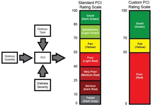
Pavement Conditioning Index
The pavement condition index (PCI) is a numerical index generally utilized for the assessment of the operational condition & structural reliability of pavements.
Estimation of the PCI is dependent on the results of a visual inspection in which the type, severity, and quantity of distresses are distinguished.
pavement distress types includes depressions, polished aggregate, rutting, potholes, block cracking, and alligator cracking.

02
Maintenance Priority Lists
Several parameters will be added to the PCI parameter to generate a maintenance priority list
Resulted maintenance priorities of roads segments has higher return on maintenance investment by up to 3x

03
Roads Management System
Mobile based tracking citizens complaints, maintenance projects and operations, and roads re-evaluation
The whole functionalities of the system is mobile based, this can allow engineers to perform all tasks in the field and in the office
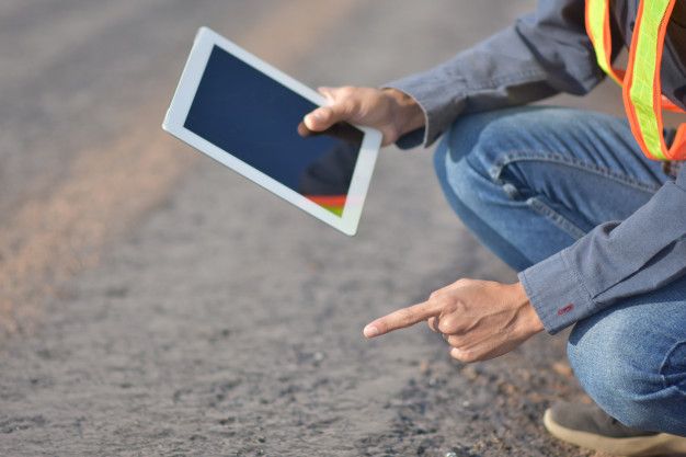
All operations can be done using one mobile application, the system can be installed on tablets, and phones
04
GIS Based maps
GIS based map of all roads defects in your city with all related data (defects types, severity, and dimensions)
All defects are presented as latitude & longitude points on maps, these points will widen the decision maker's point of view, making him more capable of taking right decisions

05
Roads Conditions Prediction
futuristic insights about roads conditions, how and where defects will occure in the future
Using more complicated algorithms, the data of roads conditions will be used in predicting how roads conditions will be in the future

06
Financial Management
How much does it cost if you perform maintenance operations, and how much it does if you don't
By integrating the roads defects and roads conditions with maintenance costs, local governments will be able to get the full picture of the maintenance cost of all roads or every single road/segment in the city
Maintenance performance could be measured according to PCI data, priority lists, and maintenance costs

Tech Company
About Us
A Palestinian startup based in Gaza. We are a group of infrastructure and civil engineers that works in the field of roads maintenance for a decade, and we want to transfer our knowledge to the world